Investigating the OSM mapping process after disasters: OsmEventAnalyst and its application for the 2016 Italian earthquakes
Luca Delucchi1, Marco Minghini2
1 Fondazione Edmund Mach, Centro Ricerca e Innovazione
2 Politecnico di Milano, Dipartimento di Ingegneria Civile e Ambientale - @MarcoMinghini
2 Politecnico di Milano, Dipartimento di Ingegneria Civile e Ambientale - @MarcoMinghini
What is the answer of community to a disaster?
OpenStreetMap and emergencies
Humanitarian OpenStreetMap Team
- Since 2009 OSM was used for humanitarian aid
- HOT was officially formed in 2010 after Haiti earthquake
- In 2013 it became a registered 501(c)3 charitable organization
- Provides services to help during humanitarian aid
- During these years it helped several disaster events providing updated maps
OpenStreetMap emergencies workflow
- People start to modify the area using old imagery data
- One or more Tasking Manager projects are activated
- The Tasking Manager should coordinate OpenStreetMap contributors' activities
Emergencies in Central Italy: a case study
- August 24, 2016, at 03:36 AM a 6.0 magnitude earthquake, the stronger tremor of a long series
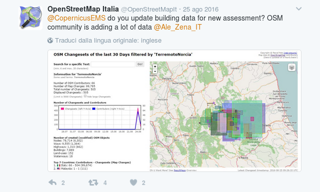
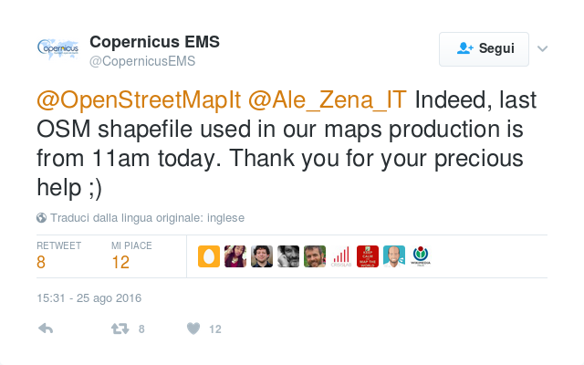
- August 24, 2016, at 05:44 AM first data added on OpenStreetMap in the earthquake area
- August 24, 2016, at 06:56 AM first message on the Italian OSM mailing list
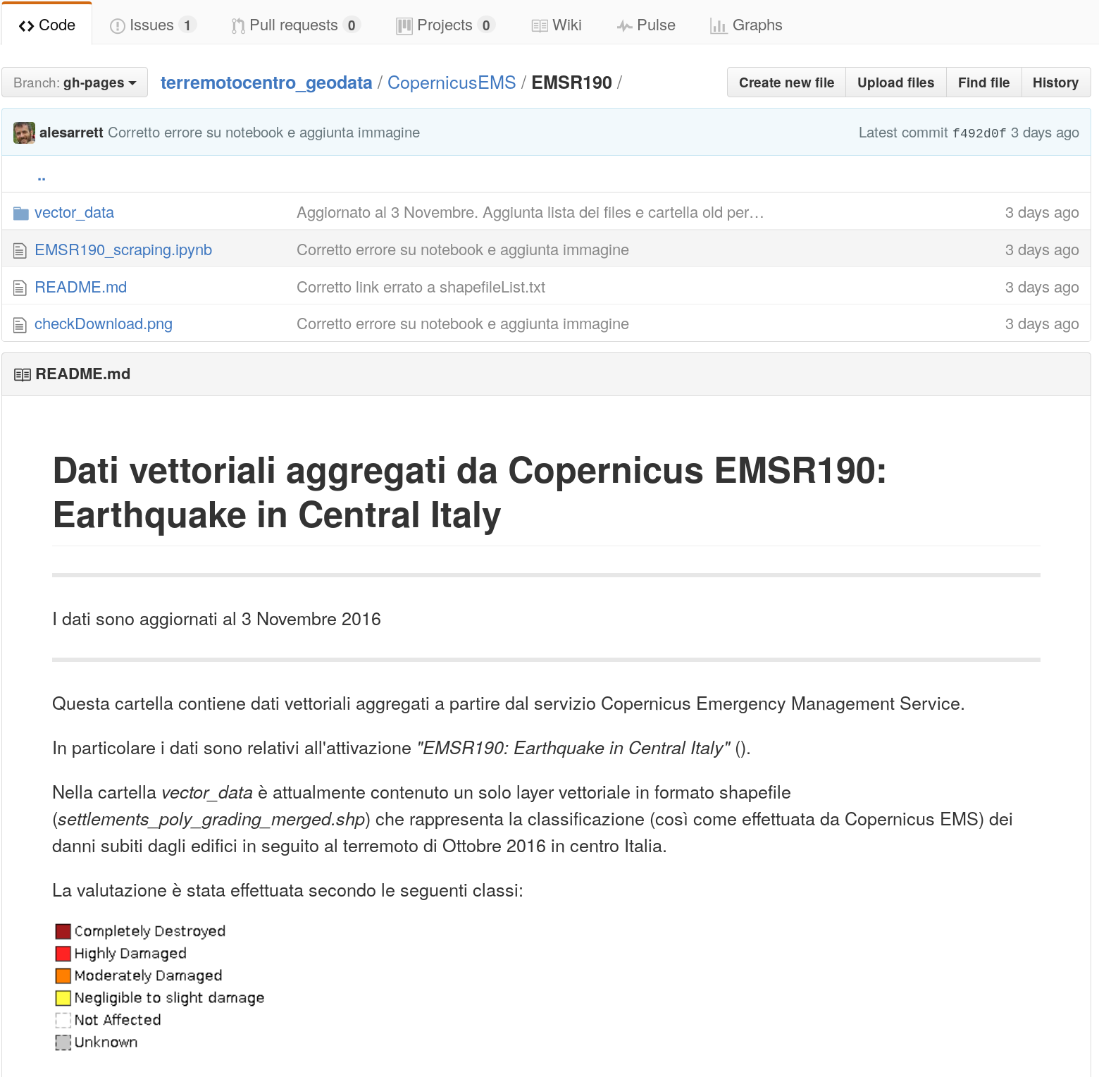
- August 24, 2016, at 11:02 AM, the first task was activated, followed by other two tasks
- October 26, 2016, at 07:11 PM a 5.3 and 09:18 PM a 5.9 a magnitude earthquake
Emergencies in Central Italy: a case study
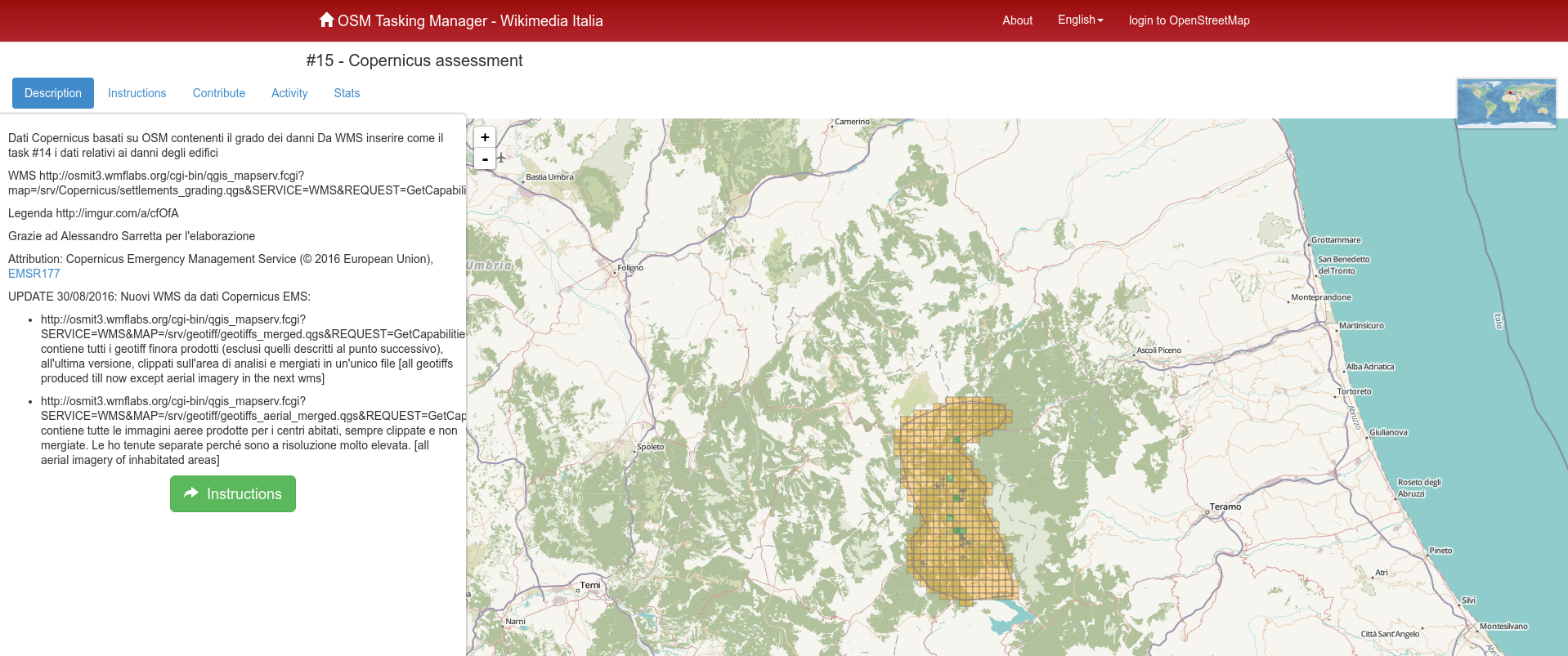 http://osmit-tm.wmflabs.org/project/15
Emergencies in Central Italy: a case study
Emergencies in Central Italy: a case study
Emergencies in Central Italy: investigation
- who partecipated to the mapping?
- what did the mappers do?
Emergencies in Central Italy: investigation
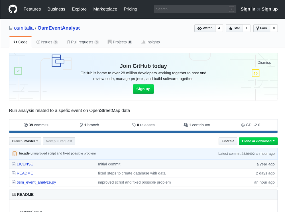
OsmEventAnalyst
Emergencies in Central Italy: study area
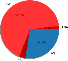
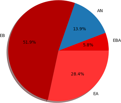
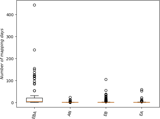
Results of Italian emergencies cases: users
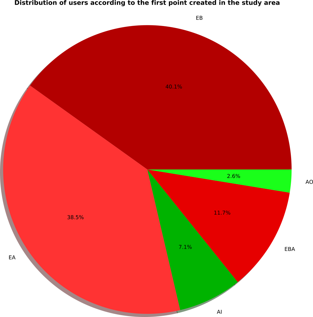
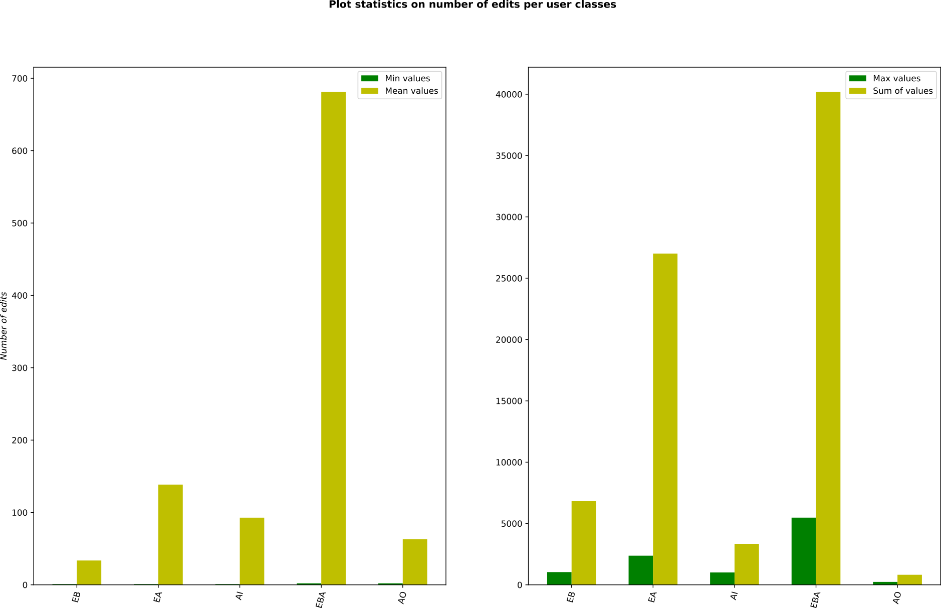
The users who modified data in the area were divided into five classes according to their OSM history:
- EB: existing users who modified the area only before the event
- EBA: existing users who modified the area both before and after the event
- EA: existing users who modified the area only after the event
- AO: users registered to OSM after the event who made the first edit outside the study area
- AI: users registered to OSM after the event who made the first edit inside the study area
Results of Italian emergencies cases: users
Results of Italian emergencies cases: users
Results of Italian emergencies cases: users
Results of Italian emergencies cases: users
Results of Italian emergencies cases: users
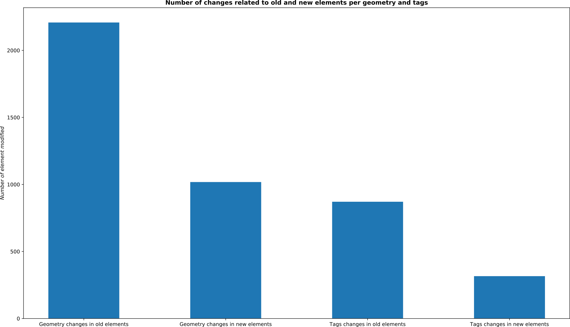
Results of Italian emergencies cases: data
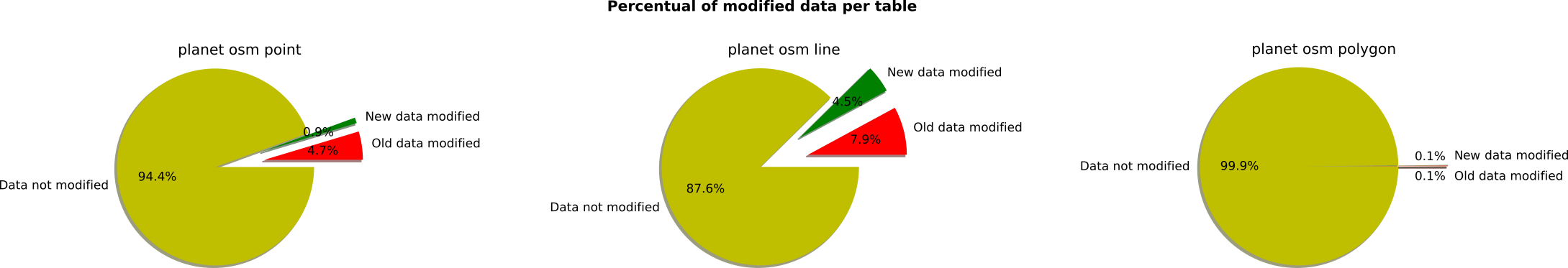
Results of Italian emergencies cases: data
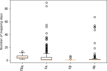
Results of Italian emergencies cases: tiles
Results of Italian emergencies cases: tiles
Results of Italian emergencies cases: conclusions
- the collaborative mapping effort was driven by already experienced users
- the analysis of the OSM data in the study area reveals that most of the objects (~90%) were not modified after the earthquakes and the objects with more changes are linear data, followed by point and polygon data (probably in other events this was different)
- the availability and activation of a TM instance is crucial to coordinate volunteers’ efforts and especially to prevent the conflicts traditionally generated when many users edit the same area in the aftermath of a disaster
Extra: new analysis
Haiti 2010
Sri Lanka 2016
Extra: new analysis
Haiti 2010
Sri Lanka 2016
Thanks to everyone
? Questions ?
Luca Delucchi - Fondazione Edmund Mach, Centro Ricerca e Innovazione
Marco Minghini - Politecnico di Milano, Dipartimento di Ingegneria Civile e Ambientale - @MarcoMinghini
Marco Minghini - Politecnico di Milano, Dipartimento di Ingegneria Civile e Ambientale - @MarcoMinghini